Nearshore Oyster Restoration Siting and Prioritization Tool


Disclaimer
The Mapping Services provided herein are for reference only. The user of this information understands and
acknowledges that the map data may be inaccurate or contain errors or omissions, and the user assumes full
responsibility for any risks or damages resulting from any use of or reliance upon these data. The National
Oceanic and Atmospheric Administration (NOAA), the Center for Coastal Resources Management (CCRM) at the
Virginia Institute of Marine Science (VIMS), and their Agents or Affiliates do not guarantee the accuracy or
reliability of the data generated from this service.
The use of the mapping tool is strongly encouraged for preliminary planning purposes; however, its use does not guarantee the approval of any authorization or shoreline project.
This project has been funded wholly by the National Oceanic and Atmospheric Administration (NOAA), NOAA Fisheries, Office of Habitat Conservation, Chesapeake Bay Office. The contents of this tool do not necessarily reflect the views and policies of NOAA, nor does NOAA endorse trade names or recommend the use of commercial products mentioned in this web interface.
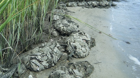 Putting loose oyster shell in biodegradable bags is one approach to reduce settling,
scattering and
siltation of the shell reef.Bagged oyster shell reefs should be carefully monitored and
broken bags
removed from the marine environment.
Putting loose oyster shell in biodegradable bags is one approach to reduce settling,
scattering and
siltation of the shell reef.Bagged oyster shell reefs should be carefully monitored and
broken bags
removed from the marine environment.
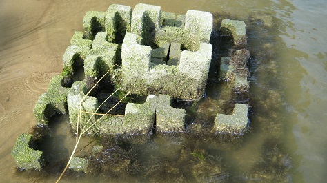
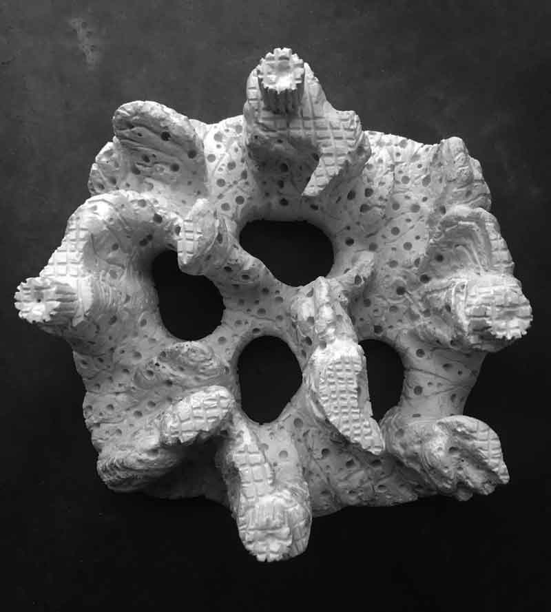
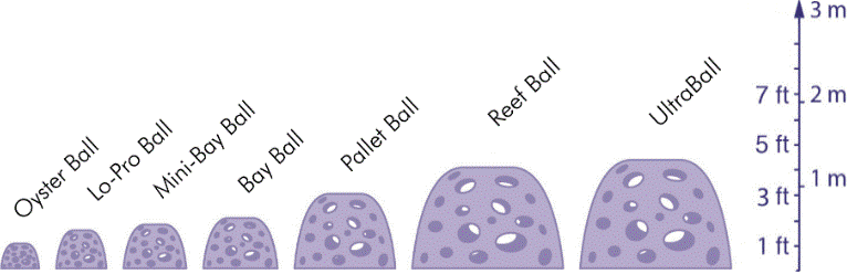
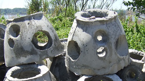 Reef Balls are a pre-cast concrete used to construct oyster
restoration reefs and living shoreline reefs. Various manufactured products can
be used to create an artificial reef foundation that supports the settlement and
growth of
shellfish.
Individual
units are typically placed close together similar to a stacked shell bag or
marsh sill
structure.
Reef Balls are a pre-cast concrete used to construct oyster
restoration reefs and living shoreline reefs. Various manufactured products can
be used to create an artificial reef foundation that supports the settlement and
growth of
shellfish.
Individual
units are typically placed close together similar to a stacked shell bag or
marsh sill
structure.
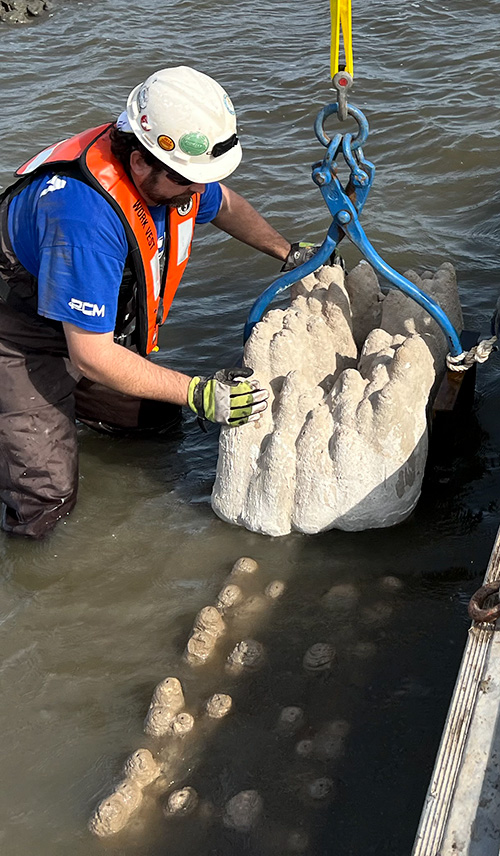
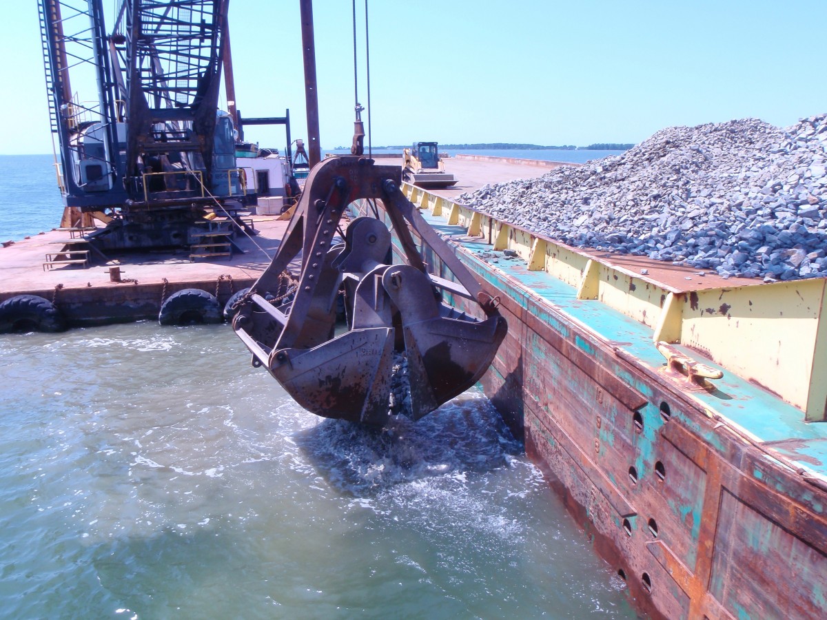 Stone
can be used as a substrate for artificial reefs.
Stone
can be used as a substrate for artificial reefs.